Weather
Hurricane Isaias Strengthens in Gulf of America as Warnings Cover Florida Panhandle
8 PM EDT update: Isaias weakens to Category 2 with 110-mph winds as landfall nears in western Florida Panhandle
Staff Writer
Oct 9, 2026
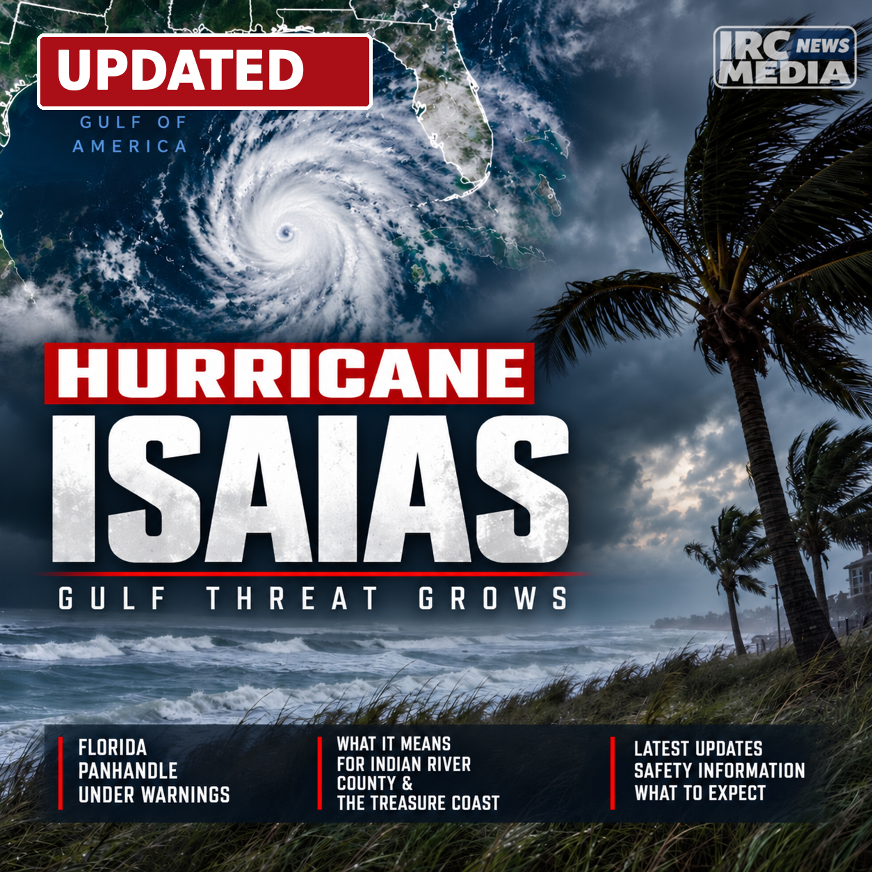
UPDATE — FRIDAY, OCTOBER 9, 2026 | 8:00 P.M. EDT — NHC INTERMEDIATE ADVISORY #13A
Hurricane Isaias has weakened to Category 2 strength but remains a dangerous hurricane approaching landfall in the western Florida Panhandle. The National Hurricane Center’s Intermediate Advisory Number 13A, issued at 8:00 p.m. Eastern (7:00 p.m. Central), reports maximum sustained winds of 110 mph, down from 115 mph at 5:00 p.m. Eastern. The center was near 30.1 degrees north, 86.6 degrees west, about 45 miles southeast of Pensacola, moving north at 18 mph. Minimum central pressure was estimated at 967 millibars.
The NHC expects the center to make landfall along the western Florida Panhandle within the next one to two hours. Hurricane conditions and extreme gusts are spreading across the warning area. A weather station in Gulf Breeze recently measured sustained winds of 83 mph with a gust to 97 mph, while Pensacola International Airport reported a gust to 71 mph.
No changes to coastal watches and warnings were announced. Hurricane warnings remain in effect from Ocean Springs, Mississippi, to the Bay/Gulf County line in Florida. Storm surge warnings extend from the mouth of the Mississippi River to the Suwannee River. The NHC continues forecasting storm surge of 6 to 9 feet above ground level from the Alabama–Florida border to Grayton Beach, with damaging winds, flooding rain and possible tornadoes elsewhere across the threatened region.
Although maximum sustained winds have decreased, the storm remains life-threatening. Residents in affected areas should stay in safe shelter, avoid travel and follow directions from local emergency management officials. Weakening is expected after landfall, with Isaias forecast to become post-tropical on Saturday.
The National Hurricane Center's 6:00 p.m. Eastern (5:00 p.m. Central) Tropical Cyclone Update reports that Hurricane Isaias is still a Category 3 hurricane with maximum sustained winds of 115 mph. The center was near 29.5 degrees north, 86.9 degrees west, about 70 miles south-southeast of Pensacola, Florida, moving north at 17 mph. The estimated central pressure was 958 millibars, down from 959 millibars in the 5:00 p.m. Eastern advisory. Maximum sustained winds were unchanged.
The latest official update reports a 72-mph wind gust at Orange Beach, Alabama, and a 69-mph gust at NOAA buoy 42012 off Pensacola. These observations show increasingly dangerous winds reaching the northern Gulf Coast as the hurricane approaches landfall.
The NHC corrected its initial 6:00 p.m. Eastern position bulletin to revise the distance estimates. The corrected distances are approximately 70 miles south-southeast of Pensacola and 105 miles southeast of Mobile, Alabama. Earlier copies of this hourly update listed 60 miles and 95 miles, respectively. The storm's estimated coordinates, wind speed, motion and central pressure did not change in that correction.
The western Florida Panhandle, including the Pensacola, Gulf Breeze, Navarre Beach and surrounding coastal communities, remains under dangerous conditions. Hurricane and storm surge warnings continue in portions of the northern Gulf Coast, and the previously forecast 6-to-9-foot storm surge remains a serious risk from the Alabama–Florida border east to Grayton Beach. This hourly position update did not announce new warning boundaries. Residents in warning areas should remain in safe shelter and follow instructions from local emergency managers.
UPDATE — FRIDAY, OCTOBER 9, 2026 | 5:00 P.M. EDT — NHC ADVISORY #13
Hurricane Isaias has weakened slightly but remains a dangerous Category 3 hurricane as it approaches the northern Gulf Coast. In Advisory Number 13, issued at 5:00 p.m. Eastern (4:00 p.m. Central) on Friday, October 9, the National Hurricane Center reported maximum sustained winds of 115 mph, down from 120 mph in the 4:00 p.m. Eastern position update. Residents in hurricane and storm surge warning areas were urged to seek safe shelter as conditions deteriorated.
The center was near 29.2 degrees north, 87.0 degrees west, approximately 90 miles south of Pensacola, Florida, and 125 miles south-southeast of Mobile, Alabama. Isaias was moving north at 17 mph, and its estimated minimum central pressure remained 959 millibars. Forecasters reported that increasing southwesterly wind shear was making the hurricane less symmetric, but the slight reduction in peak winds did not remove the threat of destructive conditions along the coast.
The National Hurricane Center announced no changes to coastal watch and warning boundaries with this advisory. The existing Hurricane Warning from Ocean Springs, Mississippi, to the Bay/Gulf County line in Florida and Storm Surge Warning from the mouth of the Mississippi River to the Suwannee River remain in effect. The highest previously forecast surge range for the Alabama–Florida border to Grayton Beach is 6 to 9 feet above ground level, with additional dangerous surge possible elsewhere along the Panhandle and Big Bend.
Life-threatening coastal flooding, destructive winds, flash flooding and tornadoes remain concerns for communities along and inland from the northern Gulf Coast. The hurricane is expected to make landfall within the warning area tonight. The Florida Panhandle and Big Bend remain the primary Florida risk areas; Vero Beach, Sebastian and Fellsmere are outside the hurricane warning zone. People in affected communities should follow local emergency management and National Weather Service instructions.
UPDATE — FRIDAY, OCTOBER 9, 2026 | 4:00 P.M. EDT — NHC TROPICAL CYCLONE UPDATE
Hurricane Isaias remains a Category 3 hurricane with maximum sustained winds of 120 mph as its center moves closer to the western Florida Panhandle. In a Tropical Cyclone Update issued at 4:00 p.m. EDT (3:00 p.m. CDT), Friday, October 9, the National Hurricane Center located the center near 29.0°N, 87.1°W, approximately 90 miles south of Pensacola, Florida, and 115 miles south-southeast of Mobile, Alabama.
The hurricane is now moving north at 17 mph, compared with a north-northeast motion at 17 mph reported at 3:00 p.m. EDT. Its estimated central pressure remains 959 millibars. The hourly position update does not constitute a new forecast track or announce any change to coastal watch or warning boundaries.
Weather conditions are rapidly deteriorating along the northern Gulf Coast. The NHC reported a recent 47-mph wind gust at Navarre Beach, Florida, and a 56-mph gust at NOAA buoy 42012.
The Florida Panhandle continues to face dangerous wind and coastal flooding threats as Isaias approaches landfall. The most recent full NHC advisory projected storm surge of 6–9 feet above ground level from the Alabama–Florida border to Grayton Beach, Florida, with significant rain and flooding possible across the Panhandle and Big Bend. These forecast impacts were not revised in the 4:00 p.m. position update.
Indian River County, including Vero Beach, Sebastian and Fellsmere, remains outside the Panhandle hurricane warning area. Residents in threatened coastal areas should follow current evacuation and safety instructions issued by local authorities.
UPDATE — FRIDAY, OCTOBER 9, 2026 | 3:00 P.M. EDT — NHC HOURLY POSITION UPDATE
The National Hurricane Center’s 3 p.m. Eastern (2 p.m. Central) Tropical Cyclone Update places Category 3 Hurricane Isaias near 28.7 degrees north, 87.1 degrees west, about 125 miles south of Pensacola, Florida, and 140 miles south of Mobile, Alabama. Maximum sustained winds remain 120 mph and the estimated minimum central pressure remains 959 millibars. The storm is moving north-northeast at 17 mph.
Compared with the 2 p.m. Eastern intermediate advisory, Isaias has moved north-northeast from 28.4 degrees north, 87.2 degrees west, when it was about 145 miles south of Pensacola. Its reported forward speed increased from 16 to 17 mph, while sustained winds and minimum central pressure did not change. The NHC also reported a recent 43-mph wind gust at Apalachicola, Florida.
The NHC says tropical-storm conditions are spreading onshore along the northern Gulf Coast. This hourly update does not announce changes to hurricane, tropical-storm or storm-surge warning boundaries, nor does it provide a new forecast track. Dangerous winds, coastal flooding, heavy rain and a tornado threat remain concerns for the Florida Panhandle and surrounding Gulf Coast. Residents should follow current National Weather Service advisories and local evacuation instructions. Earlier advisories and the original report are preserved below.
UPDATE — FRIDAY, OCTOBER 9, 2026 | 2:00 P.M. EDT — NHC INTERMEDIATE ADVISORY NUMBER 12A
At 2 p.m. Eastern (1 p.m. Central), the NHC reported that tropical-storm conditions were beginning along the northern Gulf Coast. Category 3 Hurricane Isaias was centered near 28.4 degrees north, 87.2 degrees west, about 145 miles south of Pensacola, moving north-northeast at 16 mph, with maximum sustained winds of 120 mph and a minimum central pressure of 959 millibars. Dauphin Island, Alabama, had recently reported a 47-mph wind gust.
The NHC made no changes to coastal watches or warnings in Advisory 12A. Hurricane Warnings remained in effect from Ocean Springs, Mississippi, to the Bay/Gulf County line in Florida. Storm Surge Warnings remained from the mouth of the Mississippi River to the Suwannee River, with a Storm Surge Watch from the Suwannee River to Yankeetown. The agency continued to forecast a potential 6–9 feet of surge above ground level from the Alabama–Florida border to Grayton Beach, 4–7 feet from Grayton Beach to Indian Pass, and 4–6 feet from Indian Pass to the Steinhatchee River.
The NHC forecast landfall within the warning area Friday evening at or near major-hurricane strength. Tropical-storm conditions were beginning, with hurricane conditions expected Friday evening into early Saturday. The Florida Panhandle and Big Bend faced forecasts of 4–8 inches of rainfall with isolated totals up to 15 inches, along with flooding and possible tornadoes. Conditions and figures in this section reflect the 2 p.m. advisory; the newer 3 p.m. position update appears above.
UPDATE — Friday, October 9, 2026 | 12:00 p.m. EDT — NHC Hourly Position Update
The National Hurricane Center’s noon Eastern Tropical Cyclone Update places Category 3 Hurricane Isaias near 27.9 degrees north, 87.2 degrees west, about 180 miles south of Pensacola, Florida. Isaias is moving north-northeast at 16 mph, with maximum sustained winds still at 120 mph and a minimum central pressure of 959 millibars. Those wind and pressure readings are unchanged from the 11 a.m. Eastern advisory.
The center moved north-northeast from 27.7 degrees north, 87.3 degrees west at 11 a.m., when it was approximately 195 miles south of Pensacola. The NHC also reports that NOAA Saildrone SD-1045, operating near Isaias’s eyewall, recently recorded a wind gust of 104 mph.
This hourly position and observation update does not announce new hurricane or storm-surge warning boundaries or a revised landfall forecast. The previously issued hurricane and storm-surge warnings remain in effect for portions of the Florida Panhandle and northern Gulf Coast. Residents in threatened areas should follow local emergency management instructions, especially evacuation orders, as dangerous conditions approach.
This noon update is part of IRC Media’s ongoing coverage. Our earlier updates and original October 8 report are preserved below; the newest official NHC advisory should always take precedence over older measurements.
UPDATE — Friday, October 9, 2026 | 11:00 a.m. EDT — NHC Advisory Number 12
In its 11 a.m. Eastern advisory, the National Hurricane Center reported that Category 3 Hurricane Isaias remained at 120 mph with a minimum central pressure of 959 millibars. Its center was near 27.7 degrees north and 87.3 degrees west, about 195 miles south of Pensacola, Florida, moving north-northeast at 16 mph.
The NHC indicated a slight eastward adjustment in its projected path toward the extreme western Florida Panhandle, with the possibility of major-hurricane conditions at landfall. Hurricane and storm-surge warnings remained in place along the affected northern Gulf Coast. Florida’s western Panhandle faced dangerous wind, surge and flooding threats.
Later observations are reported in the noon update above. The full earlier Category 3 upgrade report and original article remain below.
UPDATE — Friday, October 9, 2026 | 8:20 a.m. EDT — CATEGORY 3 HURRICANE
Hurricane Isaias has strengthened into a Category 3 major hurricane in the Gulf of America, with sustained winds of 120 mph, according to a special National Hurricane Center Tropical Cyclone Update issued at 8:20 a.m. Eastern Daylight Time Friday, October 9. This is the newest confirmed intensity report in IRC Media’s continuing coverage of the storm as it approaches the northern Gulf Coast.
Air Force Reserve Hurricane Hunter aircraft measured a minimum central pressure of 959 millibars. The storm was centered near 27.0 degrees north, 87.6 degrees west, about 240 miles south of Pensacola, Florida, moving north-northeast at 15 mph. The upgrade raises Isaias from Category 2 to Category 3 on the Saffir-Simpson Hurricane Wind Scale. A Category 3 hurricane is considered a major hurricane.
What Changed Since The Prior Report
The latest NHC special update increases maximum sustained winds from 110 mph in the 8:00 a.m. intermediate advisory to 120 mph at 8:20 a.m. That is a 10 mph increase and an upgrade to major-hurricane status. The special update does not announce new coastal watches or warnings, nor does it issue a new detailed storm-surge forecast.
Florida Panhandle And Gulf Coast Threats
Existing hurricane and storm-surge warnings affect portions of Florida’s Panhandle and the northern Gulf Coast. The NHC’s corrected 8:00 a.m. forecast highlighted the possibility of 6 to 9 feet of storm surge above ground level between the Alabama–Florida border and Grayton Beach, with 4 to 7 feet possible farther east to Indian Pass. These are forecast ranges from the earlier advisory, not newly revised estimates from the 8:20 a.m. update. Actual flooding depends on location and timing, and can be particularly dangerous in low-lying areas.
Residents in the warning areas face potential destructive winds, coastal flooding, heavy rainfall, tornadoes and dangerous surf as Isaias approaches. People should follow local evacuation instructions and National Weather Service alerts, and avoid entering flooded roadways.
Treasure Coast And Indian River County
The NHC hurricane warning area does not include Vero Beach, Sebastian or Fellsmere. The primary hurricane threat remains concentrated along the northern Gulf Coast, although residents elsewhere in Florida should monitor their local National Weather Service forecasts for separate rainfall and marine hazards.
This update reflects the National Hurricane Center’s 8:20 a.m. EDT Tropical Cyclone Update. The previous October 9 update and the original October 8 report are preserved below for context. Earlier storm measurements and warning boundaries are historical and should not be mistaken for the latest conditions.
UPDATE — Friday, October 9, 2026 | 2:00 a.m. EDT NHC Advisory
Hurricane Isaias remains a powerful Category 2 hurricane as it moves north-northeast through the Gulf of America, with hurricane and storm surge warnings in effect across portions of the northern Gulf Coast, including Florida’s Panhandle.
The National Hurricane Center’s Intermediate Advisory Number 10A, issued at 2:00 a.m. Eastern Daylight Time Friday, placed the hurricane near 25.8 degrees north and 88.4 degrees west, about 230 miles south of the mouth of the Mississippi River. Maximum sustained winds were 105 mph, movement was north-northeast at 14 mph, and minimum central pressure was 972 millibars. Both NOAA and Air Force Hurricane Hunter aircraft were investigating the storm.
What has changed since IRC Media’s original October 8 report
When IRC Media’s original report was prepared, Isaias had just reached hurricane strength with 75 mph winds and was moving east-northeast at 9 mph. By Friday’s 2 a.m. Eastern update, its sustained winds had risen to 105 mph, putting Isaias at Category 2 strength. Its movement had turned toward the north-northeast and increased to 14 mph. The storm’s strength and proximity to the Gulf Coast make this a more urgent threat than described in the original early Thursday report.
Warnings and Florida impacts
In Advisory 10A, the National Hurricane Center reported no changes to coastal watches and warnings. A Hurricane Warning remained in effect from Ocean Springs, Mississippi, to the Bay/Gulf County line in Florida. A Storm Surge Warning remained in effect from the mouth of the Mississippi River to the Suwannee River in Florida. A Tropical Storm Warning covered the Florida coast east of the Bay/Gulf County line to the Aucilla River, while a Storm Surge Watch continued from the Suwannee River to Yankeetown.
Dangerous coastal flooding, destructive winds, heavy rainfall and possible tornadoes threaten the Florida Panhandle and adjoining Gulf Coast communities as the hurricane approaches. Residents should heed local emergency-management instructions, including any evacuation orders, and avoid traveling through flooded areas. Forecast intensity and exact impacts can still change.
Indian River County and the Treasure Coast
Vero Beach, Sebastian, Fellsmere and nearby Treasure Coast communities remain outside the hurricane and tropical storm warning areas listed by the NHC. The principal hurricane threat remains on the northern Gulf Coast. Locally, residents should rely on National Weather Service Melbourne forecasts for any developing rainfall, flooding, surf or marine hazards rather than treat the Panhandle warnings as applying to Indian River County.
This Friday update is the latest information in this report. IRC Media’s original October 8 article is preserved below as a record of what forecasters reported at that time; its earlier storm measurements and warning boundaries are historical, not current conditions.
ORIGINAL REPORT — Thursday, October 8, 2026
Hurricane Isaias intensified overnight in the Gulf of America, prompting urgent preparations along the northern Gulf Coast as hurricane, storm-surge and tropical-storm warnings remain in effect across parts of Florida and neighboring states. The storm is expected to strengthen further before approaching the coast late Friday or early Saturday.
Latest National Hurricane Center advisory
According to the National Hurricane Center’s Intermediate Advisory Number 6A, issued Thursday, October 8, 2026, at 2:00 a.m. Eastern Daylight Time (1:00 a.m. Central), Hurricane Isaias was centered near latitude 23.1 degrees north and longitude 91.7 degrees west. Its maximum sustained winds were 75 mph, with higher gusts. The hurricane was moving east-northeast at 9 mph, and its estimated minimum central pressure was 981 millibars. The center was about 445 miles south-southwest of the mouth of the Mississippi River.
How the storm changed overnight
The NHC upgraded Isaias to a hurricane in a Tropical Cyclone Update issued at 11:30 p.m. Eastern on Wednesday, October 7, after Air Force Reserve Hurricane Hunter observations supported sustained winds of 75 mph. The subsequent 2:00 a.m. Eastern intermediate advisory retained that wind estimate and reported a lower central pressure of 981 millibars. The NHC expects additional strengthening through early Friday, with Isaias potentially remaining a strong hurricane when it approaches the northern Gulf Coast Friday night.
Hurricane and storm surge warnings in Florida
A Hurricane Warning extends from Ocean Springs, Mississippi, eastward to the Bay/Gulf County line in Florida. A Storm Surge Warning covers the coast from the mouth of the Mississippi River eastward to the Steinhatchee River, Florida. A Tropical Storm Warning extends along the Florida coast from east of the Bay/Gulf County line to the Aucilla River. A Storm Surge Watch remains from the Steinhatchee River to Yankeetown, Florida. The NHC reported no changes to these alerts in Advisory 6A; the warning upgrades were issued in the preceding full advisory.
Panhandle residents urged to prepare
The National Weather Service office in Tallahassee warns that Isaias may bring flooding rain, destructive wind, tornadoes and life-threatening coastal inundation, especially near and east of the center’s eventual landfall. The office is urging residents to complete hurricane preparations by midday Friday and to follow instructions from local emergency management officials, including evacuation orders where issued. A high risk of dangerous rip currents is also forecast for portions of the Panhandle beaches.
What this means for Indian River County and the Space Coast
Vero Beach, Sebastian, Fellsmere, Palm Bay and nearby Treasure and Space Coast communities are not in the hurricane warning area described by the latest NHC advisory. The National Weather Service in Melbourne says the storm’s main impacts are expected to remain well west of east-central Florida. However, a stalled frontal boundary and abundant tropical moisture are contributing to periods of showers and thunderstorms, with localized flooding possible in places that receive repeated heavy rainfall. Beachgoers and boaters should watch for changing rip-current and marine conditions; NWS Melbourne expects boating conditions to deteriorate into the weekend.
What to do now
Residents and visitors along Florida’s Gulf Coast should closely monitor updated NHC advisories and their county emergency management agencies. People in hurricane or surge warning areas should review evacuation zones, secure outdoor items, charge essential devices, prepare medications and supplies, and avoid driving through flooded roads. Indian River County residents should keep monitoring local National Weather Service forecasts for rain, coastal and boating hazards rather than assume the hurricane warning extends across the state.
Continuing coverage
IRC Media will continue following official National Hurricane Center and National Weather Service updates as Hurricane Isaias approaches the northern Gulf Coast. Forecast details and warning boundaries can change; readers should consult the latest advisory before making safety decisions.
IRC Media uses aggregated public data and verified sources; articles reviewed by editorial team to the best of our ability.